Land Surveyors in Moreton Bay
We support civil and commercial projects with accurate survey data, experienced surveyors and clear communication.
Land Surveyors Supporting Projects in Moreton Bay
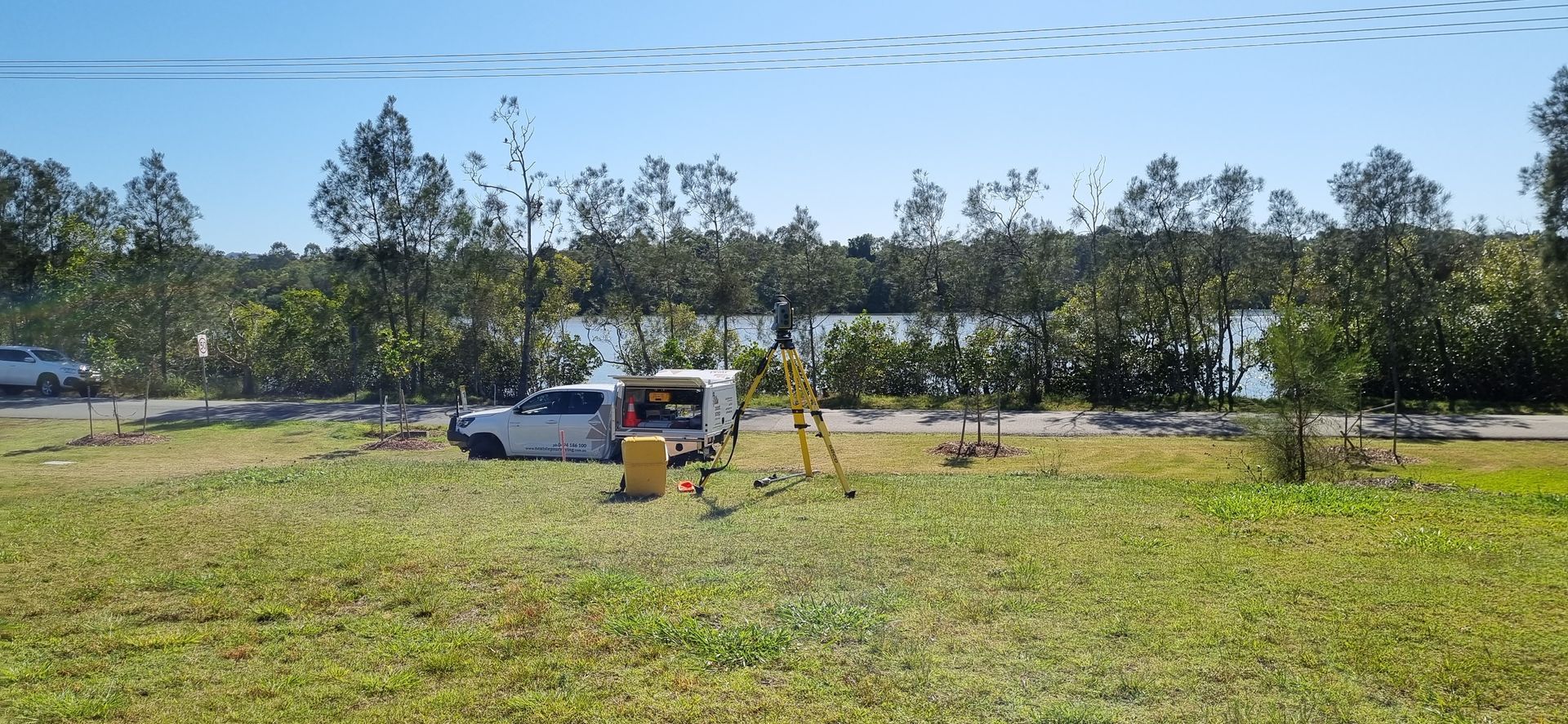
Next Step Surveying provides professional surveying services for projects across Moreton Bay and surrounding areas. We’re a family-owned surveying business based in Caloundra on the Sunshine Coast, delivering clear communication and practical survey support across residential, commercial and civil projects.
As experienced land surveyors, we support projects through property surveying, topographic surveying, engineering surveying, construction surveying and UAV scanning. We also provide pre-design surveys and mapping services from early planning through to construction.
Our team works regularly on projects throughout Moreton Bay, maintaining clear communication and consistent involvement from start to finish. To discuss your project, call 0494 186 100 and speak directly with our team.
Family Owned
Practical Surveying
Clear Communication
Property Surveying in Moreton Bay
Our team delivers property surveying in Moreton Bay, providing clear and reliable boundary and title information to support confident decision-making. As land surveyors working across a range of project types, we focus on confirming property details accurately before plans progress or ownership matters are finalised.
Our property surveying services are designed to provide:
- Clear identification of boundaries & extents
- Survey information suitable for planning & ownership needs
We review existing records and confirm conditions on site so survey information reflects what’s actually there. Survey details are presented clearly and explained where needed, helping land owners, consultants and project teams move forward with fewer questions. Explore our property surveying services to see how we can support your project.
Topographic Surveying in Moreton Bay
Our team provides topographic surveying in Moreton Bay, capturing site features, surface levels and physical constraints to support informed design decisions. As land surveyors, we focus on delivering survey information that is practical and easy for consultants to work with.
Our topographic surveying services are designed to provide:
- Detailed capture of site features & surface levels
- Survey data suitable for design & coordination
Each survey is tailored to suit how the information will be used during planning and design. Data is supplied in formats that consultants can work with easily, supporting smoother coordination as designs develop. Learn more about our topographic surveying services and how they support early project stages.
Engineering Surveying in Moreton Bay
Engineering surveying supports accuracy and consistency as construction progresses. Our team delivers engineering surveying in Moreton Bay to assist with set-out and verification across different build stages. As land surveyors experienced in construction environments, we understand how reliable control supports alignment and build quality.
Our engineering surveying services are designed to provide:
- Reliable control for construction set-out
- Verification to confirm alignment with design
We work closely with builders and engineers, providing survey input when it’s needed on site. Regular checks are carried out as work progresses to maintain accuracy and reduce issues later. Explore our engineering surveying services to support your project.

Construction Surveying in Moreton Bay
Once construction is underway, survey support needs to adapt as site conditions change. Our team delivers construction surveying in Moreton Bay to support sequencing, set-out and ongoing checks throughout the build. As land surveyors working alongside site teams, we focus on providing survey information that works in real construction environments.
Our construction surveying services are designed to provide:
- Accurate set-out during construction stages
- Ongoing checks to support build accuracy
We remain involved throughout the build, adjusting survey input as required. Information is delivered clearly and set out in a way that works on site, helping keep work moving and reducing avoidable delays. Learn more about our construction surveying services for active sites.
UAV Scanning in Moreton Bay
UAV scanning provides an efficient way to capture detailed site information where aerial data adds value. Our team delivers UAV scanning in Moreton Bay to support planning, assessment and spatial analysis without disrupting site activity. As land surveyors combining aerial and ground-based methods, we focus on accuracy and usable outputs.
Our UAV scanning services are designed to provide:
- Efficient capture across large or complex sites
- Aerial data suitable for analysis & modelling
The information we deliver is prepared with practical use in mind, making it easier for project teams to review and apply. UAV scanning is used selectively alongside traditional survey methods where it adds clarity. Explore our UAV scanning services to see how they can support your next project.
Contact Our Team in Moreton Bay
Planning a project in Moreton Bay and need reliable survey support?
Get in touch with our team and we’ll help you move forward with confidence.
Contact Us
Thank you for contacting Next Step Surveying.
We will get back to you as soon as possible.
Oops, there was an error sending your message.
Please try again later.